The Burren. A two-inch map of the uplands of north-west Clare.
Roundstone, Co. Galway, Folding Landscapes, Map printed by the Print Consortium of Ireland, 1999. 104 x 73 (unfolded). Map inside small plastic sleeve. As new.
EUR 75,-- Order
The catalog contains 49 items. Drop search results and show the complete catalog.
Order by: Author · Title · Keyword · Year · Price (up) · Price (down) · Inventory Number · Recent Changes · Relevance
History of Mayo.
Five Volumes. Ballina, Brendan Quinn, 1993, 1996, 2000, 2002. 25 x 15 cm. xvii, 447 / xv, 435 / xvi, 472 / xv, 466 / xiii, 590 pages. Illustrated. Original cloth with gilt titles on spine. In original dust jackets. Illustrated end papers (maps). Fine condition. A bright and clean set.
EUR 550,-- Order
Third District of the Eastern Part of the County of Mayo. Plate XVI. No. 1 – Third Report of the Commissioners on the Nature and Extent of the Bogs in Ireland.
[London], House of Commons, 1814. max. 95 x 65 cm. Irregular Shape. Single sheet map – folded. Unbound. Very good condition. Minor shelf wear and age darkening.
EUR 150,-- Order
Map of the Southern Part of District No. 8. Surveyed by order of the Commissioners for Improving Bogs in Ireland. [Plate 5 – Third Report of the Commissioners on the Nature and Extent of the Bogs in Ireland.
[London], House of Commons, 1814. c. 57 x 54 cm. Single sheet map – folded. Unbound. Very good condition. Minor edgewear and age darkening.
EUR 150,-- Order
Map No. 7 of the Lough Neagh District. Surveyed by order of the Commissioners for Improving Bogs in Ireland. [Plate XXIV. No. 7 – Third Report of the Commissioners on the Nature and Extent of the Bogs in Ireland.
[London], House of Commons, 1814. c. 59 x 50 cm. Single sheet map – folded. Unbound. Very good condition. Minor edge wear and age darkening.
EUR 150,-- Order
Map No. 6 of the Lough Neagh District. Surveyed by order of the Commissioners for Improving Bogs in Ireland. [Plate XXIII. No. 6 – Third Report of the Commissioners on the Nature and Extent of the Bogs in Ireland.
[London], House of Commons, 1814. c. 54 x 44 cm. Single sheet map – folded. Unbound. Very good condition. Minor edge wear and age darkening.
EUR 150,-- Order
Map No. 4 of the Lough Neagh District. Surveyed by order of the Commisioners for improving Bogs in Ireland. Plate XXI. No. 4. Third Report of the Commisioners on the Nature and Extent of the Bogs of Ireland.
[London], House of Commons, 1814. c. 68 x 56 cm. Single page map – folded. Unbound. Very good condition. Minor edgewear and age darkening.
EUR 150,-- Order
Map No. 3 of the Lough Neagh District. Surveyed by order of the Commisioners for Improving Bogs in Ireland. Plate XX. No. 3. Third Report mof the Commisioners on the Nature and Extent of the Bogs in Ireland.
[London], House of Commons, 1814. c. 66 x 56 cm. Single sheet map. Folded. Unbound. Very good condition. Minor edgewear and age darkening.
EUR 150,-- Order
Map No. 2 of the Lough Neagh District. Surveyed by order of the Commissioners for Improving Bogs in Ireland. [Plate XIX. No. 2 – Third Report of the Commissioners on the Nature and Extent of the Bogs in Ireland.
[London], Ordered by the House of Commons to be Printed, 1814. 64 x 52 cm. Single page – folded. Unbound. Very good condition. Minor shelf wear and age darkening. Scarce.
EUR 150,-- Order
Map of Part of the Bogs in the District of Lough Corrib. Plate XIII. No. 4. Levelled and Surveyed by Order of the Commissioners for Enquiring into the NAture etc. of the Bogs of Ireland.
[London], House of Commons, 1814. c. 50 x 38 cm. Single sheet map – folded. Unbound. Very good condition. Minor edge wear and age darkening.
EUR 150,-- Order
Map of Part of the Bogs in the District of Lough Corrib in the County of Galway. Levelled and Surveyed by Order of the Commisioners for Enquiries in the Nature etc. of the Bogs of Ireland. Plate Xi. No. 2. Third Report of the Commisioners.
[London], House of Commons, 1814. c. 54 x 46 cm. Single sheet map – folded. Unbound. Very good condition. Minor edgewear and age darkening.
EUR 150,-- Order
Map of part of the Bogs in the District of Lough Corrib in the Counties of Galway & Mayo. Plate X. No. 1. Third Report of the Commisioners on the Nature and Extent of the Bogs of Ireland.
[London], House of Commons, 1814. 46 x 46 cm. Single sheet map – folded. Unbound. Very good condition. Minor edgewear and age darkening. Short closed tear.
EUR 150,-- Order
Map of the Bogs of District No. 12 in the Queen’s County. Plate VII. Drawn by order of the Commissioners for the Improvement of the Bogs in Ireland.
[London], House of Commons, 1814. c. 69 x 56 cm. Single sheet map – folded. Unbound. Very good condition. Minor sedge wear and age darkening.
EUR 200,-- Order
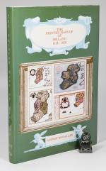
The Printed Maps of Ireland 1612 – 1850.
First Edition. Dublin, The Neptune Gallery, 1997. 30 x 20 cm. 334 pages. Illustrated throughout. Original green cloth. In original unclipped dust jacket, now inside archival jacket. Near fine in near fine dust jacket. Small number written onto rear paste down. A bright and clean copy of this scarce reference book.
EUR 275,-- Order
Nature Trails. The Open Forest. A Guide to Areas which are open to the Public.
Dublin, Forest and Wildlife Service, 1972. Folding plastic pocket with 12 folding maps / route guides (Number 5 both in Irish and English), the others 1-10 plus Avondale Forest Park all in English. Very good condition. Some shelf wear, rubbing and bumping. A little dust dulled.
EUR 38,-- Order
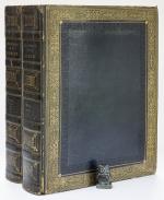
History of the City of Dublin. Containing its Annals, Antiquities, Ecclesiastical History & Charters, its present extent, public buildings, schools, institutions etc., to which are added Biographical Notices of eminent men, and copious appendices of its population, revenue, commerce and literature. Illustrated with numerous Plates, Plans and Maps.
First Edition. Large Paper Edition. Two Volumes – Complete. London, Printed for T. Cadell and W. Davies in the Strand, 1818. 32 x 25 cm. Vol.1: Frontispiece (Map), Title Page, (6) [Dedication & Preface], xx, 668 pages & 17 Plates / Vol.2: Folding Map of Dublin, Title page, (6) [Dedication & TOC], pages 669 to 1348, cvi, (6) [Corrections & Additions], 9 Plates (incl. one folding Plate) and a large folding Map of the Canals in Ireland. Some small Illustrations in text and numerous Tables and Lists. Some losely inserted newpaper cuttings. Contemporary full straight grained dark blue morocco. Blind tooled borders. Gilt decorations and titles. All edges gilt. Very good condition. Some shelf wear, rubbing and bumping. Volume 1 with some damp staining. Both volumes show mild age darkening and occasional mild foxing. Overall a very nice set in a sturdy attractive binding.

EUR 880,-- Order
Philips’ Handy Administrative Atlas of England & Wales. A Series of detailed County Maps …
London, George Philip and Son, ND [1928]. 19 x 12 cm. 23 pages, 64 colour maps, 34 pages [statistics]. Original blue cloth. Hard cover. Very good condition. Edges and end papers dust dulled. Internally clean. A nice copy.
EUR 40,-- Order
Geographia Antiqua. Smalcaldensis Geographia antiqua. Recognita denuo, & ad veterum novorumque scriptorum fidem, historiocorum maxime idemtidem castigata & Quinta editione plurimis locis aucta et immutata.
London, S. Ballard, J. Senex, G. Innys, J. Osborn, & T. Longman, 1731. c. 20 x 12 cm. viii, 180 pages. 26 (of 27) Maps, lacking map of ‘Acarnania, Graecia Propria & Peleponnesus. Contemporary calf. Raised bands. Red speckled edges. Very good condition. No free end papers. Binding rubbed and bumped. Hinges tender. Lacking one map. Otherwise a very nice clean copy. See images.
EUR 240,-- Order
Atlas Portatif et Itineraire de L’Europe. Pour Servir D’Intelligence Au Guide des Voyageurs Dans Cette Partie Du Monde; Compose de Treize Cartes et Vues.
Huitième Edition. Paris, Chez Hyacinthe Langlois, Libraire – Geographe, 1817. 22 x 15 cm. Half title, title page, followed by 10 (of 13) folding Maps. See list below. Full vellum. New spine label. Good condition. Lacking two of the alpine panoramas and the map of Italy. Remaining maps in good to very good condition. Some dust dulling, edgewear and mild staining.
EUR 150,-- Order
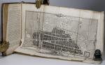
An Historical, Geographical, Commercial and Philosophical View of the American United States, and of the European Settlements in America and the West-Indies. [Contents of Volume 4: History of the British Settlements in America, History of American Quadrupets, Birds, Reptiles, Fish, Insects, Appendices: Treaties between his most Christian Majesty and the thirteen United States of America].
Volume 4 ONLY. London, Printed for the Editor, J. Ridgway, H.D. Symonds & D. Holt, 1795. 21 x13 cm. (6) [FP, TP, TOC], 415 pages, 54 pages [Appendices], (20) [Index, Directions for the Binder, List of Subscribers]. Complete with two large folding maps, folding tables and numerous Plates showing American Animals. New (2024) half cloth over marbled boards. Hard cover. Green spine label with gilt title. New end papers. See images. Very good condition. New attractive binding. Mild damp staining (red stains) to top edge, mainly first and last pages. Mild age darkening.
EUR 250,-- Order
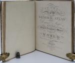
Smith’s Classical Atlas & New General Atlas (two Atlases bound into one). Full Titles: 1. Smith’s Classical Atlas Containing Distinct Maps of the Countries described in Ancient History both Sacred and Profane / 2. Smith’s New General Atlas Containing Distinct Maps of all the Principal Empires, Kingdoms, & States Throughout the World. Arranged According to the General Treaty signed in Congress at Vienna, June 1815.
London, Printed for C. Smith, Mapseller extraordinary to his Majesty, 1820 & 1822. c. 40 x 32 cm. Classical Atlas: Engraved title page, TOC, 14 Maps, incl. eight double paged / 2. Engraved title page, TOC, 49 Maps, incl. 7 doubled paged. Complete with all maps, as listed in the TOCs. Contemporary half leather over marbled paper boards. Rebacked in 2024 using the original boards and spine. New end papers. Very good condition. Binding rubbed and bumped with minor material losses to spine ends and corners. Ages age darkened. Internally clean with mild dust dulling and occasional very mild foxing. Some neat annotations to some maps, mainly Britain and Europe. Overall a very nice copy of two atlases, published in 1820 and 1822, bound into one.
EUR 2.000,-- Order
Atlas de l’ancienne Géographie Universelle comparée à la Moderne. Precede D’Une Table General, en Forme de Dictionnaire, de tous les noms anciens des Royaumes, Provinces, Villes, Fleuves, Rivieres, Lacs, Montagnes, etc., qui se trouvent dans l’Ancienne Geographie universelle.
A Paris, Andre Augustin Lottin / Arthus Bertrand, An IX. (1801). 29 x 22 cm. Title page, TOC, 78 pages, (2). Complete with 18 Maps, as listed. Order: 1-11, 15, 16, 17, 18, 12, 13, 14. Most Maps folding. Contemporary half calf over marbled boards. Very good condition. Minor shelf wear, rubbing and bumping. Edges and end papers dust dulled. Small paper sticker with name of previous owner on title page and one more location. All Maps in very good condition, with some showing some creasing and edge wear. Map 10 (Grece) with closed tear of c. 6 cm. Overall a very good copy.
EUR 320,-- Order
The Scandinavian Kingdom of Dublin.
First Edition. Dublin, Alex. Thom & Co, 1881. c. 24.5 x 15.5 cm. cxxiii, 300 pages. Complete with seven folding maps / plates, as listed. Contemporary textured brown cloth. Blind decorations and gilt title on spine. Very good condition. Some shelf wear, rubbing and bumping. Spine ends frayed. Front free end paper missing. Binding weak, but holding. Mild foxing to first and last few pages. All maps in excellent condition.
EUR 250,-- Order
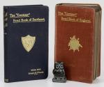
The Contour’ Road Book of England / Scotland. A Series of Elevation Plans of the Roads with Measurements and Descriptive Letterpress.
Two Volumes. London / Edinburgh, Gall & Inglis, 1913 / 1923. 15 x 9 cm. England: 848 pages plus Index and folding map / Scotland: 288 pages plus Index. Original cloth bindings with gilt titles and decorations. Very good condition. See images.
EUR 45,-- Order
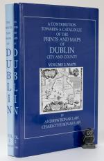
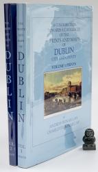
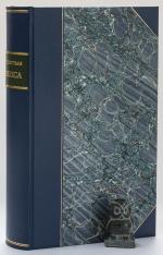
A Contribution towards a Catalogue of the Prints and Maps of Dublin City and County. Volume 1: Prints. Volume 2: Maps.
First and Limited Edition of 500. Set 97. Shankill Castle, Co. Dublin, The Neptune, 2005. 29 x 21 cm. Vol.1: x, (2), 248, (10) [Index] / Vol.2: ii, pages 251 – 411, (10). Illustrated throughout. Original dark blue cloth. Gilt titles. Inside original decorated dust jackets, now inside clear archival jackets. Near fine books inside very good dust jackets. Volume 1 inscribed and signed by the Author. Very clean copies. Dust jackets with minor edge wear. Overall a very nice set.
EUR 300,-- Order
Encyclopaedia Britannica. Three Plates Volumes with 460 Plates. Volumes 1, 3 & 4 (including the Plates issued as a Supplement in 1801-03.
Third Edition & Supplement to 3rd Edition. Three volumes of four. [Edinburgh], [Privately published by Andrew Bell, Archibald Constable & Colin Macfarquhar], [1788 – 1803]. c. 26 x 20 cm. Vol.1: Plates 1 – 161 / Vol. 3: Plates 292 – 446 / Vol. 4: Plates 447 – 542 and 1 – 50. See comments below for noted ‘anomalies’. Contemporary half calf over marbled boards. Red spine labels with gilt title. Gilt decorations and volume numbers in gilt. Very good condition. Bindings rubbed and bumped with wear to spine and ends and corners (see images). Edges age darkened. Joints cracked, but bindings remain sound. Spine leather dried and cracked. Internally dust dulled, but generally clean. A few closed tears and some edge wear to some plates. Overall a very nice collection of more than 450 plates. See images.
EUR 1.500,-- Order
The Imperial Gazetteer of Scotland; or Dictionary of Scottish Topography. Compiled from the most recent Authorities. And forming a complete Body of Scottish Geography. Physical, Statistical, and Historical. Illustrated with a complete County Atlas, various chorographical Maps, Plans of Ports, Harbours, and interesting Views.
Two Volumes – Complete. London and Edinburgh, A. Fullarton & Co., ND (c. 1860). 25 x 16.5 cm. Vol.1: lxviii, 816 pages / Vol.2: 872 pages. Both volumes with coloured maps, and B&W plates. Volume 1 with a large folding map of Scotland (repaired in the back). Contemporary half calf over cloth covered boards. Marbled edges. Gilt and blind decorations. Spine labels. Very good condition. Binding rubbed and bumped. Edges and end papers dust dulled. folding map with long closed tear, which has been repaired in the back. Internally bright and clean. A very nice copy with interesting Maps and Plates. See images.
EUR 260,-- Order
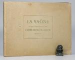
La Saone de Lyon A Corre. (Jonction au Canal de l’Est). Carte Pour La Navigation. Echelle: 1/20000 e.
2nd Edition. Lyon, Rene Salagnac, 1958. 20 x 29 cm (oblong). 21 Folding Plates (Feuillet). Original stiff cardboard covers. Stapled. Title on front board and spine. Very good condition. Minor shelf wear and dust dulling. Internally bright and clean.
EUR 40,-- Order
Macmillan’s General and Regional Geography of Ireland. Illustrated with Maps, Diagrams etc. For Primary and Secondary Schools.
London, Macmillan and Co., 1930. 18 x 13 cm. 179 pages. With B&W Illustrations and 1 Map in Colour. Original paper warppers. Soft covers. Very good condition. Some shelf wear and dust dulling. Initial of a former owner on title pages. Internally bright and clean.
EUR 35,-- Order
Lares and Penates: or Cilicia and its Governors. Being a short historical Account of that Province from the earliest Times to the Present Day.
First Edition. London, Ingram, Cooke and Co., 1853. 22 x 14 cm. xiv, 394 pages plus two pages publishers list. Original cloth with blind and gilt decorations. Later professionally rebacked using the original boards and spine. New end papers. Very good condition. Binding rubbed, bumped, age darkened and stained. Edges age darkened. New end papers. Single stamp (Franciscan Church Waterford) on title page. Closed tear to folding map (see image). Internally clean, no annotations etc.
EUR 75,-- Order
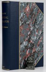
The New Practical Navigator; Being A Complete Epitome of Navigation: To which is added, all the Tables Requisite for Determining the Latitude and Longitude at Sea…
The Seventeenth Edition. Greatly Enlarged and Improved. London, Printed for Johnson, Richardson et al, 1807. 21 x 13 cm. xvi, 328 pages plus Tables. With a Frontispiece and ten Plates. New (2021) dark blue half cloth over matching marbled boards. New end papers. Gilt title and decorations. Internally age darkened and mildly foxed in places. Edges age darkened. Some of the plates with some paper losses to front edge, but not affecting actual images.
EUR 195,-- Order
A Topographical Dictionary of the United Kingdom. Compiled from Parliamentary, and other authentic Documents and Authorities; containing Geographical, Topographical, & Statistical Accounts of every District, Object, and Place in England, Wales, Scotland, Ireland and the various small Islands dependant on the British Empire. Accompanied by Forty-Six Maps, drawn purposely for this Work, on an original Plan.
First Edition. London, Printed for Richard Phillips, 1808. 21 x 13 cm. Both volumes unpaginated, c. 1000+ pages. Illustrated with 45 Maps, including 6 folding (Ireland x 2 / Scotland x 2 / Wales & Yorkshire). Note: Wales is shown on one map only, not two, as described in the ‘List of Maps’. Modern half leather over marbled boards. Black spine labels with gilt titles. Gilt decorations. Plain end papers. Very good condition. Binding as new. Internally mildly age darkened. Very few small annotations. Name of previous owner with small pencil drawing on verso of half title page. A very attractive set in a nice modern binding.
EUR 250,-- Order
An Universal History, from the earliest Account of Time to the Present. Compiled from Original Authors; and Illustrated with Maps, Cuts, Notes, Chronological and other Tables.
Volumes 2 to 19 (18 Volumes in Total). Dublin, Printed by Edward Bate, for the Editors, 1744 / 1745 / 1746. 19.5 x 12.5 cm. Vol.2: (2), 630 pages / Vol.3: (2), 645 pages / Vol.4: (2), 629 pages / Vol.5: (4), 615 pages / Vol.6: (2), 636 pages / Vol.7: (2), 653 pages / Vol.8: (2). 638 pages / Vol.9: (4), 651 pages / Vol.10: (2), 656 pages / Vol.11: (2), 632 pages / Vol.12: (2), 646 pages / Vol.13: (2). 650 pages / Vol.14: (2), 666 pages / Vol.15: (2), 724 pages / Vol.16: (2), 749 pages / Vol.17: (2), 813 pages / Vol. 18: (2), 706 pages / Vol.19: (2), 760 pages plus 10 pages Index. For list of Plates per volume, please see comments. Contemporary uniform calf. Spine label with title in gilt. Gilt decorations on spine. Raised bands. Red speckled edges. All volumes in very good condition, except for Vol. 5, which is seriously damaged by bookworm. All volumes rubbed and bumped. Age darkened edges and end papers. Very few annotations. Top edge of volume 19 marked with red felt pen. Internally age darkened with the occasional closed tear. Some plates with closed tears and poor folding. Overall a very nice and interesting set with some amazing Plates and Maps.
EUR 1.650,-- Order
A Contribution Towards a Catalogue of the Prints and Maps of Dublin City and County. Volume 1: Prints / Volume 2: Maps.
First Limited Edition. 25/500 (Vol.1) & 136/500 (Vol.2). Two Volumes – Complete. Shankill, Co. Dublin, Published by The Neptune, 2005. 29 x 20 cm. Vol.1: x, (2), 248, (14) / Vol.2: ii, pages 251 to 411, (10). Illustrated thoughout. Original dark blue cloth with gilt title on spine. Inside original decorated dust jackets (now inside archival jackets). Books in very good + conditions. Dust jacket for volume 1: good condition (some creases and short close tears). Dust jacket for volume 2: very good condition. Both jackets protected by clear archival jackets. Volume 1 signed by both authors on front free end paper. Gift inscription on ffep. Books internally bright and clean. A nice and rare set.
EUR 350,-- Order
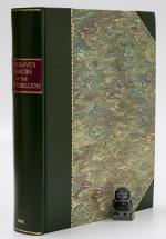
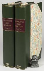
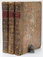
Memoirs of the different Rebellions in Ireland. From the Arrival of the English: with a particular Detail of that which broke out the XXIII D of May MDCCXCVIII; the History of the Conspiracy which preceded it; and the Characters of the principal Actors in it. Compiled from original Affiidavits and other authentic Documents and illustrated with Maps and Plates.
Dublin and London, Printed by Robert Marchbank for John Milliken and John Stockdale, 1801. 27 x 20.5 cm. x, (2), 636 pages plus 166 pages Appendix plus 10 pages Index and Errata. With 10 Maps and Plates, nine of them folding. New (2021) dark green half calf over marbled boards. New end papers. New attractive binding. Internally age darkened throughout with occasional foxing / browning. Name of previous owner in ink on first blank. Internally clean. All 10 Plates present, however, Plates 1 & 3 appear to be facsimiles.
EUR 420,-- Order
A New Collection of Voyages, Discoveries and Travels. Containing whatever is worthy of Notice, in Europe, Asia, Africa and America… (Vol.VII Only). Contents: An Account of the Country and Constitution of Great Britain… / A short general description of the City of London… / An Account of the Kingdom and Laws of Scotland… / A short View of the Naval Transactions of Britain… / A List of the Royal Navy of Great Britain 1762.
First Edition. Volume 7 [of 7] Only! London, Printed for J. Knox, 1767. 21 x 12.5 cm. 528 pages. With three folding maps (one incomplete) and five Plates. (see comments and images). Original calf. Two spine labels. Raised bands. Gilt title on spine. Very good condition. Binding rubbed and bumped. Age darkened throughout. Some stains and closed tears. City map of London lacks some parts. Other maps with small tears and poor folding. Sound binding. Internally clean.
EUR 220,-- Order
Switzerland. Illustrated in a Series of Views taken expressly for this Work by W.H. Bartlett; Esq.
First Edition. London, George Virtue, 1836. 27 x 21 cm. Vol.1: (4), 188 pages, engraved title plus 57 Plates (see comments!) / Vol.2: (2), 152 pages, engraved title plus 48 Plates, plus a folding map of Switzerland in the back. Contemporary half morroco over marbled boards. Marbled end papers and edges. Gilt titles and decorations on spine. Good condition. Binding rubbed and bumped. Edges age darkened. Rear free end paper of Vol.1 and front free end paper of Vol.2 missing. Some tissue guards missing. Names of previous owners neatly inscribed in ink. Internally with some browning, foxing and large visible damp stains on most pages, incl. Plates. (see images).
EUR 240,-- Order
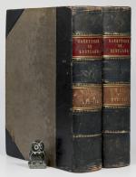
Memoirs of the Different Rebellions in Ireland from the Arrival of the English. Also, A Particular Detail of that which broke out the XXIID of May, MDCCXCVIII, with the History of the Conspiracy which preceded it.
The Third Edition. Two Volumes. Dublin, Printed for Robert Marchbank, 1802. 20 x 12 cm. Vol.1: xviii, 583 pages. With eight fold-out maps. / Vol.2: vii, 552 pages plus 15 pages Index. With one map and a view, both foldout. New (2018) dark green half calf over decorated boards. Gilt decorations. Gilt titles on red label on spine. Pale blue end papers. Very good condition. Binding new. Edges age darkened. Occasional mild browning / foxing, mainly to first and last pages. A few minor closed tears. Map X: ‘Movement of Marquis Cornwallis’ missing from volume 2. Otherwise a very nice copy from the library of publisher Edmund Downey (not inscribed).
EUR 450,-- Order
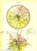
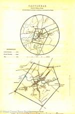
Municipal Corporation Boundaries Ireland: Castlebar. Report on Proposed Municipal Boundary of the Borough of Castlebar.
No Publishing Information. [C. 1835]. 33 x 21 cm. Two leaves from a Folio. Leave 1: Text on both sides, describing Castlebar and proposed boundary changes. Leave 2: Two small hand coloured maps on one side, verso blank. With a signature in ink below Very good condition. Mildly dust dulled.
EUR 35,-- Order
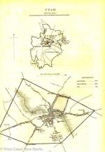
Municipal Corporation Boundaries Ireland: Tuam. Report on the Proposed Municipal Boundary of the Borough of Tuam.
No publishing information. [C. 1835]. 33 x 21 cm. Two leaves from a Folio. Leave 1: Text on both sides, describing Tuam and proposed boundary changes. Leave 2: Two small hand coloured maps on one side, verso blank. With a signature in ink below the maps. Very good condition. Mildly dust dulled.
EUR 35,-- Order
Municipal Corporation Boundaries Ireland: Sligo. Report on the Proposed Municipal Boundary and Division into Wards of the Borough of Sligo.
No Publishing Information. [C. 1835]. 33 x 21 cm. Two leaves from a Folio. Leave 1: Text on both sides, describing Sligo and proposed boundary changes. Leave 2: Two small hand coloured maps on one side, verso blank. With a signature in ink below the maps. Very good condition. A little dust dulled.
EUR 35,-- Order
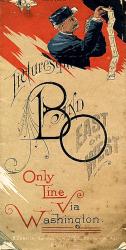
Picturesque B and O East or West. Only Line via Washington. Baltimore and Ohio Railroad Company Time Tables and Advertisement.
Chicago and Baltimore, Knight and Leonard, May, 1886. 10 x 20 cm folded. Single folded sheet with various time tables, advertisements and a large map. Colour printing. Large (80 x 40 cm) coloured map on rear. Good condition. Age darkened. Very weak folded lines with long closed tears along those folds. Minor paperlosses to some corners, not affecting text or images.
EUR 59,-- Order
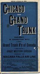
Chicago and Grand Trunk Railway, in Connection with the Grand Trunk R’y of Canada. Including Great Western Division forming the Niagara Falls Air Line.
Chicago, Jones Stationary and Printing Co., 1886. 18 x 10 cm folded. 36 x 76cm folded sheet with various time tables, advertisements and a large map (33 x 52 cm). Blue and black printing. Issued August 24, 1886. Very good condition. Mildly age darkened. Some tears along the folded lines. A few small brown spots.
EUR 69,-- Order
Rocky Mountain Health Resorts. An Analytical Study of High Altitudes in relation to the Arrest of Chronic Pulmonary Disease.
First Edition. Boston, Houghton, Osgood and Company, 1880. 20 x 14 cm. xii, 192 pages plus 18 pages of advertisement. Includes a large colour fold-out map and a large folded ‘Chest Examination Chart’ in a pocket. Dark red cloth with gilt title on spine. Hard cover. Grey end papers. Very good condition. Minor rubbing and bumping to boards, corners and spine. Spine ends frayed. Very small stain on front board. Small bookseller stamp on front paste down. Closed tear on fold-out map (not affecting the map).
EUR 150,-- Order
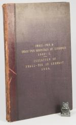
Smallpox and Smallpox Hospitals Liverpool. This book contains various reports, observations, letters etc. regarding smallpox and smallpox hospitals in Liverpool and Germany published between 1902 and 1905 namely: Text 1: Report by Dr. R.J. Reece to the Local Government Board on Smallpox and Smallpox Hospitals at Liverpool, 1902-1903. / Text 2: Observations of the Medical Officer of Health upon the Report of Dr. R.J. Reece. / Text 3: Memorandum by Dr. R.J Reece, as to questions raised by Dr. Hope regarding his report on Smallpox and Smallpox Hospitals at Liverpool 1902-03. / Text 4: Letter from W.E.Knollys, Esq. Assistant Secetary to the Local Government Board, to the Town Clerk, relating to Dr. Hope’s “Observations” on Dr. Reece’s Report. / Text 5: Letter from the Town Clerk to the Secretary of the Local Government Board, in reply to the above. / Text 5: Dr. Bruce Low’s Report to the Local Government Board on the Arrangements made in Germany fro the Isolation of Small-pox Cases.
London, Liverpool, His Majesty’s Stationary Office, City of Liverpool (C. Tinling and Co.), 1905, 1904. 32 x 21 cm. TOC typed to front paste down / Text 1: 15 pages w 23 full page maps. / Text 2. 23 pages w two large foldout maps and six digrams incl. one foldout. / Text 3: 18 ‘typed’ pages / Text 4: 3 ‘typed’ pages / 5: 15 pages plus several full page colour plates showing hospital setups in Germany. Quarter leather over clothed boards. Gilt title on spine and front boards. Small decorations. Very good condition. Boards, corners and spine rubbed and bumped. Front joint broken, but front board still attached to volume. Fading and discoloration to boards. Edges dust dulled. Some browning and age darkening to end papers. Closed tear to one of the foldout maps. Otherwise internally very clean.
EUR 220,-- Order
| Page: 1 |