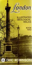
London. Illustrated Geological Walks. Book Two: West End.
Edinburgh/ London, Scottish Academic Press, 1985. 23cm x 11.5cm. vi, 142 (4) pages. Original illustrated softcover. Very good condition with only minor signs of external wear.
EUR 25,-- Order
The catalog contains 84 items. Drop search results and show the complete catalog.
Order by: Author · Title · Keyword · Year · Price (up) · Price (down) · Inventory Number · Recent Changes · Relevance
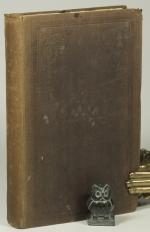
Sketches of France and Frenchmen.
London, I.J. Chidley, 1841. 21 x 13 cm. 280 pages plus six pages publishers list. Original brown embossed cloth. Hard cover with gilt title on spine. Very good condition. Rubbed and bumped with some ink stains on boards. Spine faded. Front hinge started to open. Name of previous owner in ink opposite title page. Internally dust dulled, but clean.
EUR 35,-- Order
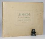
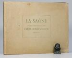
La Saone de Lyon A Corre. (Jonction au Canal de l’Est). Carte Pour La Navigation. Echelle: 1/20000 e.
2nd Edition. Lyon, Rene Salagnac, 1958. 20 x 29 cm (oblong). 21 Folding Plates (Feuillet). Original stiff cardboard covers. Stapled. Title on front board and spine. Very good condition. Minor shelf wear and dust dulling. Internally bright and clean.
EUR 40,-- Order

Tea. Its Mystery and History. With a Preface in Chinese and English by Lo Fong Loh, C.I.C.S. Secretary to the Chinese Educational Mission in Europe. Illustrated.
First Edition. London, Simpkin, Marshall & Co., 1878. 18 x 12 cm. xvi, 92 pages. With a tissue guarded frontispiece photo showing Lo Fong Loh, a facsimile in Chinese on pink paper and six Plates. Original maroon cloth. Hard cover. Gilt title and black and blind decorations. Professionally rebacked in 2025. New end papers. Very good condition. Some shelf wear, rubbing and bumping. Bindings faded (see images). Edges dust dulled. New end papers. Internally clean. Scarce.
EUR 595,-- Order
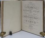
Smith’s Classical Atlas & New General Atlas (two Atlases bound into one). Full Titles: 1. Smith’s Classical Atlas Containing Distinct Maps of the Countries described in Ancient History both Sacred and Profane / 2. Smith’s New General Atlas Containing Distinct Maps of all the Principal Empires, Kingdoms, & States Throughout the World. Arranged According to the General Treaty signed in Congress at Vienna, June 1815.
London, Printed for C. Smith, Mapseller extraordinary to his Majesty, 1820 & 1822. c. 40 x 32 cm. Classical Atlas: Engraved title page, TOC, 14 Maps, incl. eight double paged / 2. Engraved title page, TOC, 49 Maps, incl. 7 doubled paged. Complete with all maps, as listed in the TOCs. Contemporary half leather over marbled paper boards. Rebacked in 2024 using the original boards and spine. New end papers. Very good condition. Binding rubbed and bumped with minor material losses to spine ends and corners. Ages age darkened. Internally clean with mild dust dulling and occasional very mild foxing. Some neat annotations to some maps, mainly Britain and Europe. Overall a very nice copy of two atlases, published in 1820 and 1822, bound into one.
EUR 2.000,-- Order
Stanfield’s Coast Scenery. A Series of Views in the British Channel, from Original Drawings taken Expressly for the Work by Clarkson Stanfield.
First Edition. London, Smith, Elder and Co., 1836. 22 x 16 cm. viii, 128 pages. Complete with 40 tissue guarded Plates and one Vignette. Contemporary half leather over textured cloth. Gilt title and decorations. All edges gilt. Marbled end papers Very good condition. Binding rubbed and bumped. Internally dust dulled and occasionally mildly foxed / spotted. See images.
EUR 120,-- Order
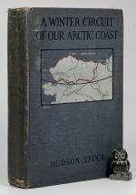
A Winter Circuit of our Arctic Coast. A Narrative of a Journey with Dog-Sleds around the entire Arctic Coast of Alaska.
First Edition. New York, Charles Sribner’s Sons, 1920. 23 x 15 cm. x, (4), 347 pages. Illustrated. With two folding maps and 33 Images. One plate (page 302: ‘Cooking Dog-Feed’ missing). Original cloth binding. Very good condition. Rubbed and bumped. Binding faded (see images). Binding a little shaky with some pages towards the back of the book lose). One plate missing. Overall a nice copy.
EUR 65,-- Order
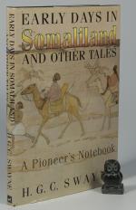
Early Days in Somaliland and other Tales. A Pioneer’s Notebook.
First Edition. Durham, The Pentland Press, 1996. 23 x15 cm. vi, 233 pages. Illustrated throughout with maps and B&W photographs. Original black cloth with gilt title on spine. In original dust jacket. Illustrated end papers (map). Very good in very good dust jacket. Top edge dust dulled, otherwise, as new.
EUR 45,-- Order